
Architects routinely confront frustrating gaps between what exists on a physical site and what appears in their digital models. Manual surveys consume hours of labor yet still produce measurements riddled with small inaccuracies that compound into costly design errors downstream. Tape measures miss hidden geometries, hand-drawn sketches lose dimensional nuance, and revisiting a site to verify a single dimension can derail an entire project timeline. LiDAR technology and 360° scanning have emerged as transformative solutions that close this gap with remarkable precision. By capturing millions of spatial data points in minutes, these tools generate accurate digital twins of existing conditions, enabling architects to design with confidence rather than assumption. Combined with advances in 3D real estate photography, scanning workflows now integrate seamlessly into BIM environments, improving collaboration among project stakeholders while dramatically reducing rework. This article provides architects with actionable insights on adopting LiDAR and scanning technologies to enhance measurement accuracy, streamline site documentation, and ultimately deliver designs that align precisely with real-world conditions from the very first iteration.
The Fundamentals of LiDAR Technology for Architectural Applications
LiDAR technology—Light Detection and Ranging—works by emitting rapid laser pulses that bounce off surfaces and return to a sensor, measuring the precise distance to each point. Thousands of these measurements per second generate dense point clouds: three-dimensional datasets containing millions of spatial coordinates that collectively describe a building’s geometry with millimeter-level fidelity. Originally developed for topographic mapping and aerospace applications, LiDAR has evolved into an indispensable architectural tool as scanners have become more portable, affordable, and software-compatible. For architects, this technology addresses a fundamental need: creating accurate 3D models from existing conditions without the time penalties and error margins of manual documentation. A single scanning session lasting minutes can capture an entire room’s geometry, structural elements, mechanical systems, and surface textures simultaneously. The process is entirely non-invasive, requiring no physical contact with historic or fragile structures. Critically, LiDAR output integrates directly with BIM platforms like Revit and ArchiCAD, allowing architects to model over verified spatial data rather than approximated dimensions.
How LiDAR Scanning Transforms Site Documentation
The scanning process begins with positioning the LiDAR unit at strategic locations throughout a site to ensure complete coverage with minimal occlusion. The scanner rotates, firing laser pulses across its field of view, and registration software automatically stitches overlapping scans into a unified point cloud using common reference targets or feature-matching algorithms. From setup to final capture of a medium-sized commercial interior, the entire process typically takes one to three hours—compared to days of manual surveying for equivalent coverage. Traditional tape measures introduce cumulative human error, particularly across long distances or irregular geometries, and photogrammetry struggles with textureless surfaces and consistent lighting requirements. LiDAR overcomes both limitations by measuring geometry directly through laser time-of-flight calculations regardless of surface appearance or ambient conditions. The resulting point cloud data feeds into multiple deliverable types: dimensionally accurate floor plans, section cuts through any plane, detailed 3D mesh models for visualization, and volumetric calculations for space planning—all derived from a single capture session and all traceable back to verified spatial measurements.
Leveraging 360° Scanning for Comprehensive Site Analysis
While LiDAR excels at geometric precision, 360° scanning captures the full visual context of a space by recording panoramic imagery from every vantage point. Unlike limited-angle photography that forces architects to mentally reconstruct what lies beyond the frame, 360° scanning documents every surface, corner, and transition in a continuous spherical view. This completeness proves invaluable during design development when architects need to reference site conditions without returning physically—checking ceiling details, verifying material transitions, or confirming the relationship between structural elements and adjacent spaces. The immersive virtual walkthroughs generated from 360° scanning allow entire project teams to navigate a site remotely, annotate specific locations, and extract measurements directly from the captured environment. For spatial analysis, this means fewer assumptions and fewer errors: architects can verify sightlines, assess natural light penetration, and evaluate circulation patterns from their desks with the same confidence as standing on-site. Modern 360° scanning integrates tightly with design software, enabling direct overlay of captured conditions onto proposed interventions. Point-to-point measurements taken within the 360° environment maintain accuracy within acceptable tolerances for schematic and design development phases, giving architects a reliable measurement tool that complements the higher precision of dedicated LiDAR workflows. The result is a layered documentation approach where visual completeness and dimensional accuracy reinforce each other throughout the design process.
Enhancing Measurement Accuracy with Advanced Scanning Tools
Measurement accuracy sits at the foundation of every successful architectural project. A wall dimension off by even two centimeters can cascade into misaligned cabinetry, ill-fitting curtain walls, or structural connections that demand costly field modifications. Traditional measurement methods introduce error at multiple stages: the tape sags over long spans, pencil marks on field sketches lack precision, and transcription from notebook to CAD introduces yet another opportunity for deviation. Scanning tools eliminate most of these failure points by capturing geometry digitally from source to deliverable without manual intermediate steps. The laser measures directly, the software records automatically, and the architect works from data that maintains its integrity throughout the design pipeline. Beyond eliminating human transcription errors, advanced scanning tools address environmental challenges that defeat manual methods entirely—measuring across occupied spaces without disrupting furniture, capturing overhead dimensions without ladders, and documenting concealed geometries revealed only through penetrating wavelengths. Calibration protocols built into modern scanners ensure that measurement accuracy remains consistent across varying temperatures, humidity levels, and surface reflectivities. Post-processing software applies automatic error-correction algorithms that identify and reconcile inconsistencies between overlapping scan regions, flagging anomalies for manual review rather than silently propagating them into design models. For architects, this means dimensional confidence at every project phase: schematic measurements hold through design development, and construction documents reflect verified conditions rather than hopeful assumptions.
Tools and Techniques for Precise Data Capture
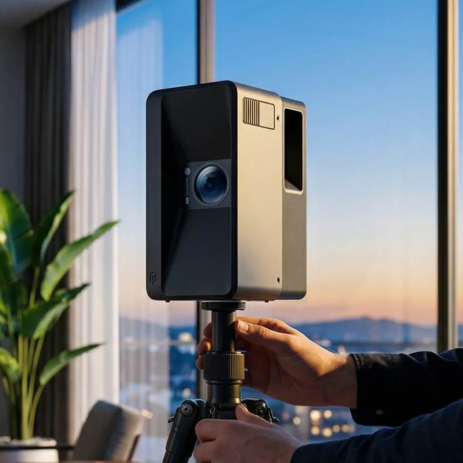
Several scanning platforms deliver the measurement accuracy architects require for design-grade documentation. The Realsee Galois stands out for its ability to produce high-fidelity point clouds suitable for both spatial documentation and detailed modeling, combining LiDAR precision with panoramic visual capture in a single device. When scanning complex environments—spaces with multiple levels, narrow corridors, or reflective surfaces—specific techniques preserve data fidelity. Position the scanner to minimize occlusion by placing it at intersections and doorways where sightlines extend into adjacent zones. Overlap scan positions by at least thirty percent to give registration algorithms sufficient common geometry for accurate alignment. For highly reflective surfaces like glass or polished stone, apply temporary matte targets that provide reliable return signals without damaging finishes. Validating measurements against known references remains essential: place calibrated scale bars within the scan field and compare their captured dimensions against certified values after processing. Cross-check critical dimensions—structural bay spacing, floor-to-floor heights, and opening widths—against at least two independent scan positions to confirm consistency. When discrepancies exceed project tolerances, rescan the affected area with tighter station spacing rather than averaging conflicting values. This disciplined approach ensures that the final point cloud meets design standards and that architects can trust extracted dimensions without secondary verification trips to the site.

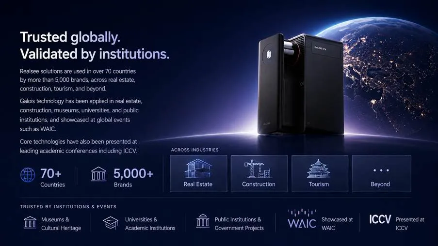
Case Study: Realsee Galois in Industrial Design Projects
A mid-sized architectural firm recently deployed the Realsee Galois to document a 12,000-square-meter industrial warehouse slated for adaptive reuse as a mixed-use creative campus. The project demanded precise documentation of steel truss systems spanning irregular bays, concrete floor elevations with subtle drainage slopes, and mechanical infrastructure suspended at varying heights—conditions that would have required weeks of manual surveying with scaffolding access. The scanning team completed full site capture in two days, positioning the Realsee Galois at 87 stations throughout the facility. The device’s combined LiDAR and panoramic capture eliminated the need for separate photography sessions, producing both dimensionally accurate point clouds and high-resolution visual documentation simultaneously. Post-processing revealed critical findings that manual surveys would likely have missed: a 14-centimeter deflection in one primary truss, inconsistent column spacing that deviated from original construction drawings by up to eight centimeters, and undocumented floor penetrations concealed beneath accumulated debris.
The resulting 3D models integrated directly into the firm’s Revit environment, where designers modeled new mezzanine insertions, curtain wall systems, and mechanical routing with full confidence in the existing structural geometry. Design accuracy improved measurably—the firm reported zero dimensional conflicts during construction documentation, compared to an average of twelve per project using their previous survey methods. The industrial design context tested the scanner against challenging conditions: dusty atmospheres, dark interiors with minimal ambient light, and highly reflective corrugated metal surfaces. Adjusting scan density in problematic zones and applying matte reference targets on reflective surfaces resolved these challenges without compromising data quality. For architectural firms considering scalability, the workflow proved repeatable: the same protocols applied successfully to three subsequent industrial projects of varying complexity, with scanning time scaling proportionally to floor area. The key lesson was that investing in thorough scan coverage upfront—even when it feels excessive—consistently prevented costly return visits and delivered design-grade accuracy from the initial capture.
Implementing 3D Real Estate Photography: A Step-by-Step Guide for Architects
Adopting 3D real estate photography as part of an architectural practice requires more than purchasing a scanner—it demands a structured workflow that ensures consistent quality from initial capture through final deliverable. Architects who integrate 3D real estate photography into their documentation process gain a competitive edge through faster turnaround, richer client presentations, and dimensionally reliable base models that reduce downstream revisions. The following steps outline a practical adoption path that balances investment with immediate returns, allowing firms to scale their scanning capabilities as project demands grow.
Step 1: Site Assessment and Scanning Preparation
Before arriving on-site with equipment, conduct a preliminary walkthrough or review available drawings to identify scan station locations, potential obstructions, and lighting conditions. Select scanning hardware based on project requirements—smaller residential interiors may need only a portable 360° scanner, while complex commercial spaces benefit from dedicated LiDAR units that combine geometric precision with panoramic imagery. Clear movable obstructions from scan paths where possible, and place calibration targets at measured intervals to provide quality-control checkpoints during processing. Verify that battery levels, storage capacity, and firmware are current before beginning capture, since interrupted scans waste time and create registration gaps.
Step 2: Data Processing and 3D Model Creation
Once raw scan data returns to the office, import point clouds into processing software that supports automatic registration, noise filtering, and coordinate alignment. Clean the dataset by removing transient objects—people, vehicles, or temporary equipment—that don’t represent permanent site conditions. Generate mesh models or structured point clouds optimized for your target platform, whether that’s a BIM environment requiring geometric accuracy or a client-facing virtual tour prioritizing visual fidelity. Validate processed models against the calibration targets placed during capture, confirming that dimensional accuracy meets project tolerances before distributing data to the design team.
Step 3: Integrating Scans into Architectural Workflows
Import finalized 3D models directly into BIM platforms as underlay references, allowing designers to trace existing conditions with verified geometry rather than approximated dimensions. Use the 3D real estate photography outputs for client presentations—immersive walkthroughs communicate existing conditions far more effectively than static photos or abstract floor plans. Share scan-derived models with structural engineers, MEP consultants, and contractors through cloud-based viewers that preserve measurement functionality without requiring specialized software. Establish a project library of scanned conditions that remains accessible throughout construction, giving field teams a reliable reference when questions arise about existing dimensions or spatial relationships.
Embracing Digital Precision for the Future of Architectural Practice
LiDAR technology and 360° scanning have fundamentally shifted how architects approach site documentation, replacing assumption-driven workflows with data-verified precision that holds from schematic design through construction. The ability to capture millions of spatial measurements in hours rather than days eliminates the cumulative errors that plague manual surveys, while immersive 360° environments keep entire project teams connected to real site conditions without repeated physical visits. PropTech innovators like Realsee demonstrate that geometric accuracy and visual documentation no longer require separate workflows—architects can achieve both simultaneously, feeding reliable data directly into BIM platforms where design decisions carry measurable consequence. Measurement accuracy ceases to be aspirational when every dimension traces back to laser-verified point cloud data rather than a stretched tape and a pencil mark. For firms seeking competitive differentiation, adopting 3D real estate photography and scanning workflows delivers immediate returns through reduced rework, faster documentation cycles, and client presentations that communicate spatial reality with unprecedented clarity. As scanning hardware continues to shrink in size and cost while growing in capability, the barrier to adoption drops further each year. Architects who establish scanning protocols now position themselves to absorb future advances—higher resolution sensors, real-time processing, and AI-driven feature extraction—without reinventing their workflows. The trajectory is clear: design accuracy increasingly belongs to those who measure digitally and model from truth.